Early on Wednesday morning, the co driver noticed smoke rising from the National Park over the highway.
I check my
Fires Near Me app and sure enough there was a small bushfire near the lake.
We thought nothing much of it at first but as the morning passed it was evident from the increasing smoke that it was developing.
Soon we knew we may have a problem on our hands. Luckily the winds were light and not blowing in our direction but it was obvious that it was getting bigger. The app map confirmed this.
As darkness fell a huge red glow spread across the eastern horizon.
Around 2am the next morning I awoke and the glow had turned bright orange and the light flooded our bedroom.
I checked the map again and sure enough the fire had taken off, jumped the lake and was heading for the village to our north. They were under a yellow alert ie.initiate evacuation plan. The firefighters had lit a back burn on one of the fire trails just over the lake to combat the spread of flames, hence the intense light.
A back burn is a deliberate fire lit in front of the bushfire along a natural (lake, river) or man made (track, road) fire break. This fire is then 'sucked' towards the bushfire by that fire's own air consumption, against the wind, eventually giving the more intense main fire nothing to burn.
This stopped the northerly spread and the alert was withdrawn.
Next morning, Thursday, the fire to the south east was still intense and due to a change of wind, heading towards us.
Water bombing helicopters were continually flying over us to the fire.
The app indicated that the firefighters were beginning a back burn along a track directly over from us and we were told by another source that the increased smoke this would cause should not be a worry.
Helicopters continued their 'attack' until 7pm when the sun began to set.
It was obvious from new app maps that the back burn had done the job but there was still an intense red glow in the sky during the night as the two fires met and burnt out.
This morning, Friday, the smoke plumes had gone but the helicopters, en masse, are back helping fire fighters on the ground mop up.
Fallen trees and burning logs have to be doused, especially around the perimeter, as any small fires left burning or smouldering can easily start a new fire if weather conditions change.
How this fire started in cool, calm autumn conditions is anyone's guess.
A campfire that got away or deliberately lit? The latter is sadly not unknown.
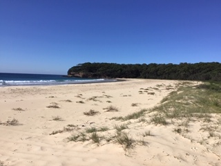
In any case, 220ha of National Park has been burnt out and a huge amount of beautiful wild flower habitat and native vegetation destroyed especially along the northern part of our beach.
But thanks to the Rural Fire Service there was no property damage.
Rain, up to 30mm, is predicted for tomorrow.
We can only hope.
Update: 10th March
No rain at all yesterday. Warm to hot and dry conditions predicted for the next week. There is no activity in the air over the fire ground but the roads in on both sides of the lake are still closed so assume they are still working on shutting it down completely.
Update: 11th March
Today we are covered in smoke. From the new app map it seems that the fire, while still under control, continues to be active as the back burns consume the last of the combustible material within the fire ground.
Update: 18th March
68mm of rain over 24 hours and the fire is finally out.
 Fire opens the hard cones and spreads the seeds which then germinate in the nutrient rich residue of the fire.