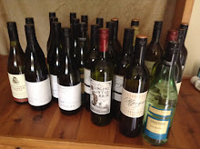
Negotiating the busy streets of Adelaide, I dropped the co driver off at another quilt shop on the list and went on to buy some wine making equipment.
On the way back I happened to pass the historic Penfolds Magill Estate, the original home of Penfolds wines and the famous Grange Shiraz. Once in the countryside, this 5ha vineyard is now completely surrounded by suburbia. I thought about stopping for a quick visit but the very pleasant day has started to turn a bit nasty and we needed to get out of town into the Adelaide Hills before peak hour.
Sure enough, in about thirty minutes, we were hit with torrential rain and howling winds just as we reached Hahndorf and our accommodation. It was in a beautiful setting despite the weather and within walking distance of a couple of wineries including the award winning Smith and Shaw.

Hahndorf is Australia's oldest surviving German settlement. Its early pioneer settlers were refugees from religious persecution in the Silesian area of Prussia (north-eastern Germany). In December 1838, thirty-eight Lutheran families arrived at Port Adelaide aboard the 'Zebra', captained by Dane, Dirk Hahn after whom the town was named. It's very touristy now and tends to be a little pseudo Deutsch but there are some nice preserved buildings here as well as some good restaurants and expensive craft shops. We chose Bistro 25 a very tiny place who despite being booked out welcomed us in from the stormy night and made room. The scallops, pate', char grilled filet were delicious. So was the complimentary glass of Nepenthe Sauvignon Blanc.

Next morning, after a wild weather night and despite no let up, we soldiered on with our exploration of quilt shops and wineries.
The Adelaide Hills are part of the Mount Lofty Ranges that lie just outside the capital. In the late 1800's wealthy residents of the city discovered that the hills provided the perfect cool retreat from the hot suburban summers. Many fine houses were built and are still occupied today. There are 30,000 residents living (and many commuting) in the area today. It is also a wine region being one of South Australia's largest as well as the oldest. The first vines were planted in the Hills in 1839, three years after South Australia was declared a state. The lowest vineyards in the region lie at an altitude of around 400m and the annual rainfall can vary between 700 and 1250mm per annum.
This cool climate is ideal for Pinot Noir, Sauvignon Blanc and crisp Chardonnay. Other grape varieties grown in the region include Merlot, Shiraz, Semillon and Cabernet Sauvignon. Vignerons are also experimenting with some of the rarer varieties in Australia eg. Trollinger and Lemberger grapes from Germany, and the Italian varieties Arneis, Sangiovese and Nebbiolo. We found the Spanish Tempranillo as well. I picked up some of that as well as a few bottles of Sauvignon Blanc from Bird in Hand winery. And they had great olives too.
The co driver had taken a liking to the typical South Australian countryside typified by dry creek beds bordered by tall river gums. She thought we should try to buy a painting or a photograph for one of our walls.

Just by chance, Hahndorf was the home of the famous German born landscape artist the late Hans Heysen and his studio, which is preserved by the National Trust, was only a few minutes from us.
We took our time wandering around and eventually ended up buying a lovely print from the NT shop there.

Two quilt shops were also on the agenda one of which turned out to be ‘the shop of the tour’. They even had a ‘waiting husbands’ chair......outside. Very considerate, I must say! And very much needed.
We also found a chocolate shop to die for. I will make no other comment. Enter the web site at your own risk!
The following morning we headed south and into the Fleurieu Peninsula with the first stop at McLaren Vale.
Only a half hour’s drive south of Adelaide, this is one of Australia's oldest wine making regions. The region consistently produces fine wines from a number of varieties, most importantly Shiraz, Cabernet Sauvignon and Chardonnay

The topography of the region is undulating and therefore contains a variety of terroirs. In the East the land rises as high as 320m but the flats mostly lie between 50-100m elevation. The different soil types include terra rossa, light loam over clay, rendzina, soldolic, and Bay of Biscay. The soil type is generally quite poor with much of it sandy with a clay base. Irrigation helps when nature is lacking, although about 20% of the region’s fruit is retained as "dry-grown" to encourage intense flavours. Warm sunny days with sea breezes from the nearby Gulf of St Vincent help temper high summer heat. Its proximity to the Mount Lofty Ranges sees cool gully winds fall down from the hills in the late evening and early morning, chilling the grapes to retain crisp acidity and structure. Good winter rainfall of 580-700mm and low relative humidity ensure consistency of ripening and premium quality fruit. We even came across a block of very old bush vines as opposed to the normal trellised ones.

It was the weekend and most tasting rooms were very busy and the staff very sales rather than information orientated. I was searching for Tempranillo and managed to find two outstanding ones at d’Arenberg and Samuel's Gorge.
Then it was onto Victor Harbor and our accommodation just the other side of Encounter Bay. I had been warned that it was in a remote area. And it was! That's it right on the point.

What an amazing spot.

The weekend’s gales were still blowing and the Southern Ocean was in full flight.
Check out the view from our front window.

And the welcoming committee.


Next morning had somewhat improved weather wise so we went to see what Victor Harbor (no, not a sudden case of American spelling but a mistake by an early Surveyor General of South Australia) had to offer.
Encounter Bay on which Victor Harbor sits was discovered and named by Matthew Flinders in the HMS Investigator in April of 1802 although there is evidence that American whalers were in the area in the 1790's. Flinders was surveying the then unknown southern Australian coast from the West and encountered Frenchman Nicolas Baudinin of the Le Geographe near the Murray River mouth several kilometers to the east. Baudin was surveying the coast from the East for Napoleonic France. The ships returned to the bay and sheltered while the captains, who were probably unaware their countries were at war, compared notes. It subsequently became a whaling station.
It gained importance as a port when goods coming down the Murray River to Goolwa couldn't be exported through the dangerous Murray mouth and were transported up the coast by Australia's first railway albeit horse drawn.

Granite Island which protects the harbour is connected to the mainland by a long causeway.
Encounter Bay on which Victor Harbor sits was discovered and named by Matthew Flinders in the HMS Investigator in April of 1802 although there is evidence that American whalers were in the area in the 1790's. Flinders was surveying the then unknown southern Australian coast from the West and encountered Frenchman Nicolas Baudinin of the Le Geographe near the Murray River mouth several kilometers to the east. Baudin was surveying the coast from the East for Napoleonic France. The ships returned to the bay and sheltered while the captains, who were probably unaware their countries were at war, compared notes. It subsequently became a whaling station.
It gained importance as a port when goods coming down the Murray River to Goolwa couldn't be exported through the dangerous Murray mouth and were transported up the coast by Australia's first railway albeit horse drawn.

Granite Island which protects the harbour is connected to the mainland by a long causeway.
There are two ways of getting over, walking or by horse drawn tram.

We needed the exercise and as well did a complete circuit of the island for a good work out plus some lovely scenery.
Granite island is home to a large colony of Fairy Penguins and are a popular attraction on the island. The penguins shelter on the island during the night, departing in the morning to hunt for fish before returning at sunset. We didn't see any.


Next stop was Goolwa. This used to be the final port of call for the paddle steamers coming down the Murray River. The river completes its 2375km (1485 mi) journey at Lake Alexandrina which then empties through a chain of low sand islands into the Southern Ocean. The largest island , directly facing the mouth, is Hindmarsh and it is from here you get a distant view of it. We could just make out a group of seals lying on the beach where the river raced out to sea.

A series of barrages join the islands, separating the salt water from the fresh water of the lakes and river. These barrages can be however opened during high river flow. The mouth is between two sandhill peninsulas. Sir Richard Peninsula on the northwest separates the Goolwa channel (the main river channel) from the ocean. The much longer Younghusband Peninsula separates the Coorong from the ocean on the southeast of the mouth.

Due to the poor water flows mention in a previous blog the mouth needs to be kept open by continual dredging. A silted up mouth would stop inflow from the sea and into the Coorong's 467 km² (180 sq. mi) lagoon system which would then warm up, stagnate and die. The Coorong is an important sanctuary for many species of birds, animals and fish as well as attracting many migratory bird species.
Lunch at Goolwa was the local specialty, battered Coorong mullet and chips. Then it was back to our coastal retreat via another listed quilt shop to prepare for the next leg of our journey.







.jpg)