We are living near Yankton on the South Dakota / Nebraska border and the banks of the mighty Missouri River. It’s about 90 minutes drive south from Sioux Falls. The town has around 13500 residents and is basically a rural centre. This is confirmed by the three huge farm equipment yards, farm chemical suppliers and cattle sale yards that line the highway as you drive into town as well as the number of times you are held up by agricultural equipment in the environs. The town spreads north over the flat prairie from the river in the typical American grid system and generally has large blocks and wide streets. The old town centre is never really busy and parking is never a problem. It seems that the active business area has moved from here to along the main north highway out of town. Peak hour traffic lasts from 4:45 to 4:47pm.
Here is some plagiarized history.
Modern-day Yankton first welcomed people onto its soil hundreds of years ago when Native Americans, from the Arikara to the Yankton Dakota Sioux Indians settled near the joining of the James and Missouri rivers.
Transplanted Americans soon followed when, in 1804, explorers Lewis & Clark passed through on their journey west. General George Custer and his cavalry also camped near Yankton in 1876 before their fateful battle with the Native Americans took place in Montana.
The wild west visited Yankton one year later in 1877 when the killer of Wild Bill Hickok, Jack McCall was hanged after his trial in town. McCall is buried in Yankton cemetery.
Steamboats passed through Yankton from the 1860s to the 1880s carrying explorers, workers and cargo. Several prominent ship captains decided to dock in Yankton and call it home.
The Benedictine Sisters soon followed to bring religion to the growing town of Yankton. They arrived in 1887 and more than a century later have contributed to the community with a regional medical center, Mount Marty College, monastery and chapel.
The Meridian Bridge, a long-time sight of the Yankton skyline, connected Yankton and Nebraska in 1924.
Big name entertainers and politicians found their start at WNAX radio, which began broadcasting in 1922. U.S. Senator Chan Gurney spread his message about aviation and Missouri River dams on WNAX. Musical giant Lawrence Welk brought his band to Yankton and received national recognition from WNAX's coverage.
The 1950s saw the creation of Gavins Point Dam, a part of the federal flood control project known as the Pick-Sloan Plan. Now one of the busiest recreation areas for fishing, swimming, boating and hiking, the Lewis & Clark Lake area greets visitors from all over. The Lake area is also home to the bald eagle and many rare and native fish species.
(©Copyright Yankton Daily Press & Dakotan)
Life in Yankton is pretty easy. Nothing much happens in a hurry.The people are friendly and always up for a chat.
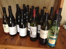
The restaurant scene is basic with lots of fast food outlets as well as the eat and run buffets but we have found a good mex and pizza place in town. There are a few smaller wine shops with a limited selection but the local HyVee supermarket has a rather large grog shop which features a good range of local as well as overseas wines. Australia is well represented although some of the brands are unknown to me. Must be a marketing thing. And it seems like stylized Aboriginal paintings on the labels are all the rage.
Amid some controversy, Wal-Mart has opened one of its supacentres in town and it’s huge! It employs 400 town people. One wonders how it can be supported but guess the surrounding rural area is the additional source of customers. It has a very “nice” gun department too. Buying a Magnum at the supermarket takes on a whole new meaning.
There’s a five screen cinema in the local mall as well as a good library. We have seen two don’t bother movies “Monster in Law” and “The Perfect Man” (isn’t that tautology?).
We went to the Lewis and Clark Theatre (classic art deco building) to see a local production of “Seven Brides for Seven Brothers” which was very entertaining. It appears the roots of American live theatre is alive and well in this town.
Just up the road is the Gavins Point Dam and its recreation area.
The dam is an important stop on the Lewis and Clark Trail. It was here at Calumet (means peace) Point that the Corps of Discovery held a three day peaceful council with the Yankton Sioux. It’s a little ironic that this historic area was three quarters destroyed during the construction of the dam wall.
We have spent a lot of time in this area sitting quietly in the many tree shaded areas reading and enjoying the water views (we both miss the ocean!). I like watching the squirrels, chipmunks and gophers “doing their thing” much to the amusement of the local resident. The other night we were there until late with friends whose kids were fishing. They brought in a huge catfish as well as a number of undersized bass and walleye. The bait they were using was live leeches. At $3 for 10 I have a fortune living around my creek at home. There is a lot of other wild life around including deer, skunks and coons not to mention rabbits. There are also reports of mountain lions……in the suburbs!
Our apartment (on a converted lumber (timber) yard) is in Utica about 12 miles northwest of Yankton. This is a micro village, four unpaved streets by four unpaved streets, with no shops, a bar and a post office as well as a huge grain silo (elevator). Utica is surrounded by corn and bean fields as well as the occasional cattle feed lot and the amazingly long, straight roads that exist in the mid west. Think of the crop dusting scene out of “North By Northwest” and you have it.
Here is some more plagiarized information.
Utica is a town located in Yankton County, South Dakota. As of the 2000 census, the town had a total population of 86.
Geography
Utica is located at 42°58'49" North, 97°29'53" West (42.980242, -97.498020)1.
According to the United States Census Bureau, the town has a total area of 0.7 km_ (0.3 mi_). 0.7 km_ (0.3 mi_) of it is land and none of the area is covered with water.
Demographics
As of the census2 of 2000, there are 86 people, 39 households, and 18 families residing in the town.
There has been considerable rain in the area over the last few weeks and many places are still flooded. The crops are suffering from the saturated soil and many of the fields are showing uneven or non existent growth. Many have been badly eroded. I would think disease could also be a problem but equipment is now only able to get on as the soil dries out. Everyone seems to be madly spraying and/or replanting. Some of the gigantic broad acre tractors and tillage equipment as well as big wheel boom sprayers you meet on the road as they move from place to place have you heading for the verge.
The bad weather has also produced its share of thunderstorms and tornados. So far we have been lucky to avoid the latter.
Most days have been cool and with our early 5:30am start you need a jacket (well I do; locals think it’s a heat wave). But now it seems summer is really coming. The next week has predicted temperatures in the 90’s (35C). And of course there’s the prairie wind. It’s akin to our black nor’easter but can blow day and night.
We make the drive to Sioux Falls on a regular basis to see family and visit friends. I am finally coming to grips with this city’s layout now that I am driving around it more instead of being chauffeured. Traffic can be heavy but it generally sticks to the 30mph (50km/hr) speed limit and drivers are mostly polite. There are virtually no round abouts so you have to deal with the four way stop signs at intersections. First there is first to go. It seems to work ok. You are also allowed in most cases to turn right after stopping at red lights. This seems to speed up traffic flow and could be introduced more in Sydney (turning left in our case, of course). There is a reluctance to use indicators which can be a bit frustrating. Also many American produced cars’ rear indicators are also the tail/brake lights. You have to get used to these red indicators (as apposed to yellow) which can be a problem, especially at night. Petrol prices are around $A0.65L. People are whinging. They don’t know how well off they are!
Our stay in Utica will come to an end this weekend. We are moving to Onamia which is about 100 miles north of Minneapolis. It’s near one of the bigger lakes in Minnesota as well the source of the Mississippi River and appears to be in the middle of a large recreation area.
Tuesday, June 21, 2005
Subscribe to:
Post Comments (Atom)


No comments:
Post a Comment